This page is a photographic overview of the beauty and mystery of Quabbin Reservoir Wilderness, and an essay on the history of Quabbin from my particular perspective.
Quabbin - Place of Many Waters

more photos after the narrative
Quabbin Wilderness was once 4 actual towns in Massachusetts, 100 miles west of Boston, which were purchased and taken in the 1920s for the purpose of creating a watershed. The residents were evicted, the towns decommissioned, the buildings razed, cemeteries relocated, and the Swift River, which ran between these four mountain towns was dammed; submerging the towns and their vestiges, leaving only their hilltops and mountain peaks as islands.
While I deem it criminal that the political elite of Boston would exploit these comparatively poor residents, history implies that the people of Dana, Prescott, Greenwich and Enfield would have eventually sold their farm land to developers, and today, this wondrous region would be nothing but strip malls, industrial parks and condominiums. So, in an odd way, the pomposity of the Bostonians resulted in something marvelous.
In the 90 years since the taking, the area has become a resurgent wilderness bounding in dense forests, wildlife, wildflowers, mushrooms, ferns and grasses. Bald eagles were reintroduced and are thriving and nesting here and can be seen routinely in the airs over the big lake. Bobcats, moose, deer, black bear, wolves, loons and a host of other mammals, reptiles and birds find a safe haven within the confines of Lady Q. The entire reservoir, including the lake and surrounding mountains and forests, is about 120 square miles of scenic, quiet, pristine splendor with traces of relics sprinkled here and there to remind of her past and to charm her visitors.
As a young boy, The Quabbin held much mystery and romantic appeal. We were told stories about former streets and railroad tracks just suddenly disappearing at water's edge, cellar holes and foundations of old farmhouses, schools, churches, businesses, clearly seen as you look down from a boat into the crystal clear waters covering what once were communities, now drowned. She is New England's factual Atlantis. There were tales of ghosts, rumors of mountain lions, stories of 4-foot lake trout and 10-pound large mouth bass.
And at about age 11 or 12, secretly in my own mind, I decided that I would live near her as an adult. Soon after the birth of my eldest son, we moved to Athol. That was 27 years ago. Since then, I have raised 4 sons in the North Quabbin region, granting to them and myself the luxury of exploring her at will; a luxury we frequently enjoyed. My sons are now grown so I hike Quabbin alone these days. Two things have occurred to me:
1 - Familiarity does NOT breed contempt! I have explored her almost daily for decades and my infatuation only grows.
2 - As I change, she changes. When I was 9, she was the fascinating place I heard so much about, full of fish and turtles and salamanders and snakes; every boy's outdoor dream. As a parent, she was the environment in which i taught my sons to love nature and wildlife and a perfect place to recreate with them through hiking and fishing. As an older adult, she is the source of my need for solitude and oneness with nature as well as my treasure chest of natural fascinations and curiosities.
I still haven't seen a mountain lion or met any ghosts while exploring Lady Q, but she never ceases to amaze me and her wonders are inexhaustible. Oh! lake trout do indeed grow to 4 feet in her protected depths. And now, we shall proceed into the photographs of The Magnificent Lady.
As indicated earlier, the lake was formed by damming the Swift River. The Swift itself was actually 3 rivers converging. Following is a series of shots I call The Seasons of Swift, taken a half mile ahead of the lake on what remains of the Middle Branch Swift River. The river was ideal for a water supply; it is shallow and unnavigable, hence, no industry ever existed along her banks.


The Seasons of Swift were taken atop this colonial era bridge, built in 1866 on a road which ran from OrangeMA to the village of Millington in what once was Prescott, MA. The bridge is now simply one of the many relics of Lady Q's past which are preserved within her confines. The most interesting aspect of this bridge from a design standpoint is that the arch is supported solely by weight distribution and a keystone; there are no dowels, concrete, or steel framework. Following is a brief history of the construction from the records in the town of New Salem:
Keystone Bridge
The Keystone Bridge is a stone-arched bridge that was built in 1866 over the Middle Branch of the Swift River on Orange Road, the main road from the Millington village in New Salem to the Town of Orange. The granite stones that form the bridge were hand fit under the supervision of Adolphus Porter.
The Keystone Bridge is a stone-arched bridge that was built in 1866 over the Middle Branch of the Swift River on Orange Road, the main road from the Millington village in New Salem to the Town of Orange. The granite stones that form the bridge were hand fit under the supervision of Adolphus Porter.

Downstream view from inside the arch.

When the residents of the former towns were evicted, they left behind many things. On a hike last year, I came across this relic, which seems to be a farm instrument of some sort.

It is a fact that while on the water, you can look down and see old foundations from the razed buildings of the flooded towns. You can also come across foundations throughout the forests surrounding the lake. I found this one last winter. It was most likely a farm house. New England is full of rocks, so in that era, farmers simply used the many rocks they came across while plowing to build foundations and property line walls, which we New Englanders refer to as fieldstone walls.
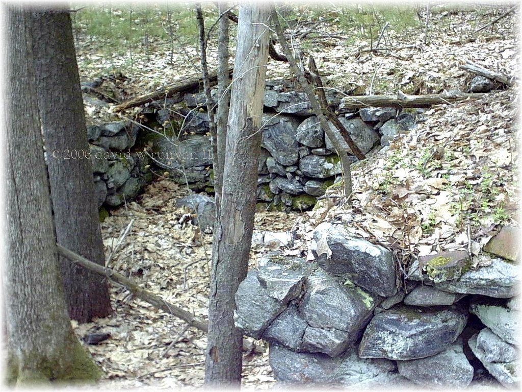
Another old Quabbin cellar hole.

This was a
fork in a road in Prescott . . . and the large boulder once housed a
metal placard instructing travelers that Dana is to the left and Enfield is to the right. In those days, the New Englanders
used rocks for everything including "highway signs" . Many such former
roads exist within Lady Q, and are now lanes for forest rangers to
travel and paths down which visitors may stroll.

This was the vault of a former cemetery in what once was Dana, MA.
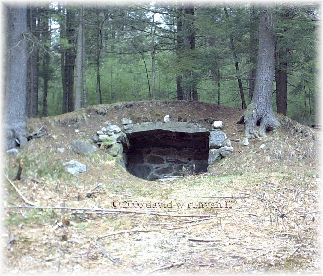
A fireplace from the past, left standing in the middle of the Quabbin forest.

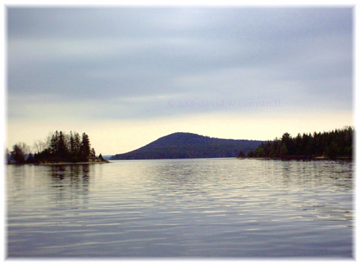
Lady Q. AquaVistas.


Story in Parting
Sweet Memories and Sad Fadings
Memories are powerful and riveting; especially when they involve charming people who have passed and are missed.Such is the story of an old woman, known to us only as Pie Lady of Quabbin. She lived on the edge of Quabbin Wilderness in a small white house with teal trim. On her property was a working water well, painted to match her house. Next to her well was a table where she placed home-baked pies and next to the pies a tray for the money.
Her pies were sold on the honor system, and while the honor system would fail miserably anywhere else in Massachusetts, Pie Lady employed it successfully in the quiet calm of Quabbin.
I came by with my children on Sundays. The children would make wishes and toss pennies into the well while I selected a pie as desert for our Sunday meal. This became a family tradition until that sad Sunday when the pies were no longer found on the table.
Since her passing, her house caught fire and has been demolished. Until last year, her slowly decaying water well remained, but this year, it too is gone. Pie Lady, her home and her well have vanished in the physical sense, but the way in which she became a beloved part of the Quabbin will not be forgotten by those who were touched by her existence.
All of us, somewhere in the recesses of our past, have known a Pie Lady or other local character who was a charming part of the community . . . in an era when both community and individualism were permitted to evolve.

I hope you've enjoyed my story and photos of the Quabbin Reservoir. I also hope they inspire you to explore her as I do, and remember our saying up here . . . take only photos - leave only footprints.
For a definitive history of the Quabbin Reservoir, I would refer you to the works of J.R.Green. You may contact him at jrg01331@webtv.net
Ask for a list of his books on Quabbin, and tell him Dave Runyan sent you.
Massachusetts official site for the Quabbin Reservoir.
back to main page